International Peace Park Tour* Part 3 *Continued from Part 1 - Part 2 Motorcycling articles by Leonard R. 
| |
Day 3. We left the park returning to Pincher Creek. We were blessed with another gorgeous day. The morning air was a little crisp, but warmed quickly allowing us to wear light clothing along with the jackets and helmets.
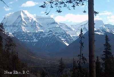
 Upon reaching Pincher Creek, we topped of the tank and turned north. About 1 mile north of town, PV # 6 ends, butting into PV # 3. We took the left fork and continued onto Sparwood, British Columbia, a distance of about 55 miles with a few tiny towns in between.. The ride to Sparwood was wonderful. The road was great, with little traffic. The trees and mountains offered more awe inspiring views. We rode past the abandoned towns of Michel and Natal. Apparently 70 or more years ago, the dust from the coal mining operations in the area, caused so much havoc that the populace could no longer breath. Eventually all the people moved, with most going to Sparwood. Michel is about two miles before Sparwood, with Natal a mile before. If you look close, you can see some remnants of the towns. Sparwood is about 4,500 population, with two small shopping centers, several gas stations and cafes. We thought it was a beautiful town with new homes and shops. We talked to a gentlemen, who said coal mining and timber were the main industries. Because the town is expanding so rapidly, more service industries will be needed in the future. When you get to Sparwood, take an hour or two and just ride around and get lost, like we did. Check out the world's largest truck. A huge green machine. We also rode into and briefly checked out a nice campground called Mountain Shadows Campground (www.mountainshadows.ca) It's wooded with tall pines. The roads are hard packed gravel and easy to negotiate. Several of the tent sites had wide enough aprons to park and turn a motorcycle around on. After Judy got me un-lost, we continued west out of town on PV # 3. Again, the views were wonderful. We passed through the small mountain town of Fernie. Fernie has a nice western looking main street, with a few newer buildings. The town looks old and rural, perhaps about the same size as Sparwood. In the center of town is a city park, which displays an old mining train and equipment. We did take a short side trip to look at Kikomun Creek Provincial Park, about 3 miles west on PV # 93, which joins # 3 at Elko. The Park has several campgrounds within. We talked briefly with a staff member who told us they do take reservations. The only campground within the park that has showers is Surveyors Lake campground. The Park sits along lake Koocanusa, which is man made, due to the Kootenay river being dammed in Montana. The park is heavily forested, with hiking trails and small streams. I think it would be a nice campground to camp at.
PV # 93 turns into U.S.# 93 as you cross back into Montana. Did I mention how pretty the scenery is? We continued on south through a couple of small towns and on into Whitefish, Montana. Whitefish is a larger town, with all the things you would need. We didn't do any touring of the town, as we were anxious to get off the bike and relax. From Whitefish it is only another 15 miles to Kalispell and our campground. We decided to have a simple meal, so we could shower and get to bed early. I've been to the Grand Canyon by car, We've been to Yellowstone National Park, Bryce Canyon National Park and countless other parks and forests on the motorcycle. All are beautiful in their own right. All are different from each other. Although Yellowstone may be just as beautiful as Waterton-Glacier, the traffic at Yellowstone will have you riding at a snails pace. We thought there was a little too much trash and clutter, which diminished the Park's beauty. Now, I understand that Yellowstone has a park & ride policy, where you park your vehicle and ride a tour bus. How boring. If I were to take one last ride to a beautiful area, it would be Waterton-Glacier. I just can't stress enough how beautiful the scenery is throughout the loop we traveled. The mountains, glaciers, streams and waterfalls are truly awesome in their beauty. The campgrounds we saw seemed well kept and clean. The roads overall were good. Traffic seemed leisurely and the drivers courteous. The Park is slightly over a thousand miles from our front door, so I know we will return in the near future. Who knows, we might just see you on the roadway.
|

 We continued through the tiny town of Elko, south past a huge ice cream cone onto PV # 93 and rode about 25 miles to Roosville, B.C. We did see a service station at Roosville and what appeared to be a café and motel. Roosville is where you cross the border back into the United States. We got to the border late in the afternoon. Crossing the border out of Canada was a breeze, but going into the United States took about an hour. We had to open the trailer and remove most of the contents. Removing items from the front and rear boots took most of time, because it's there we store all the small nonessential items. Our identifications were checked, the license plates on both the bike and trailer were checked. A few questions were asked and answered and we were on our way.